The Location Build
Using the research obtained from scouting Google Maps, I began identifying and building certain objects that would aid the line up process.

I cleaned up the satellite image, removed the modern cars and street markers, mainly to improve clarity in Maya when building the road and structures.

The image with dotted red line indicates the area in which I felt I could line up accurately. The area that has been darkened was so different to the plate, these areas were only roughly matched.
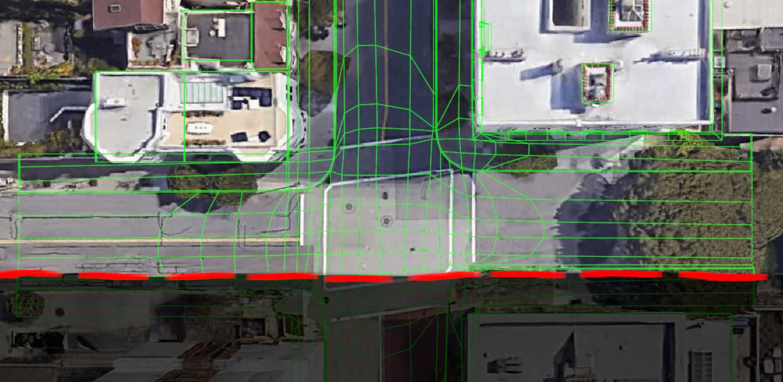
A satellite image of the street intersection with the CG location wireframe overlaid. This is where I had to make calculated decisions, so many years have passed since Bullitt was filmed so I decided to concentrate on certain landmarks.

This is my rough guide for areas where I wanted to concentrate getting the line up solid. The Ford was useful for working out a rough height for the camera and making sure I wasn’t too central on the street.
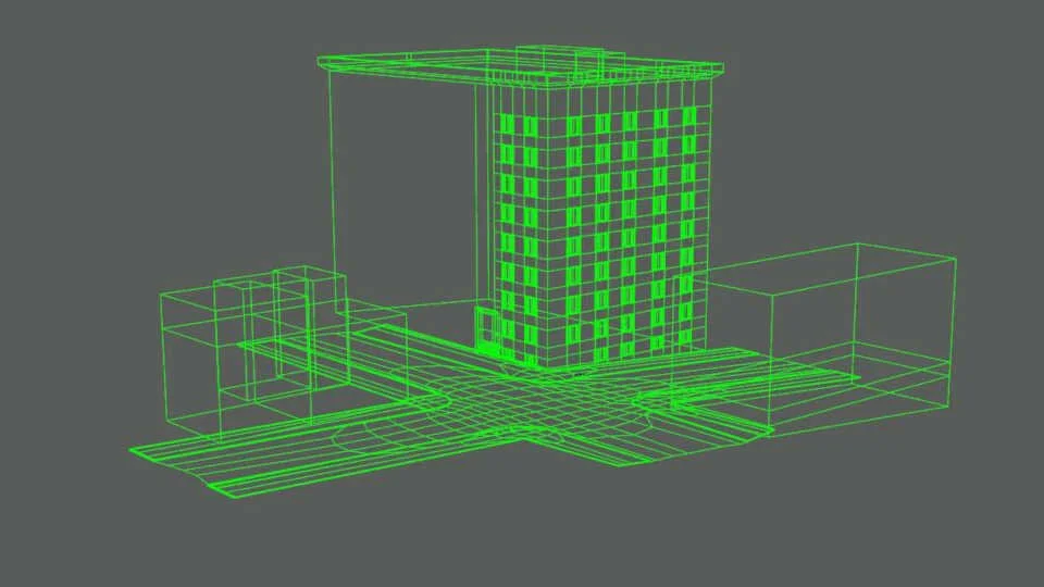
The main location was modelled from the Google Earth satellite views. I was confident that it made sense when compared to the original plate.

Adding window detail helped to further check the camera placement during the lineup stage.

A dark shape that sits behind a telegraph pole near the parked car is a US mail box. Even though this is a small detail, any additional information only helped the lineup.

The parked car in the back of the plate seemed to match the look of a 1964 Chevy Impala. Modelling this seemed to be a little unnecessary but the research was there if needed.

The Ford Fairlane has a very distinctive grill so that made it easy to narrow down the search, this information was obtained from the behind the scenes documentary.